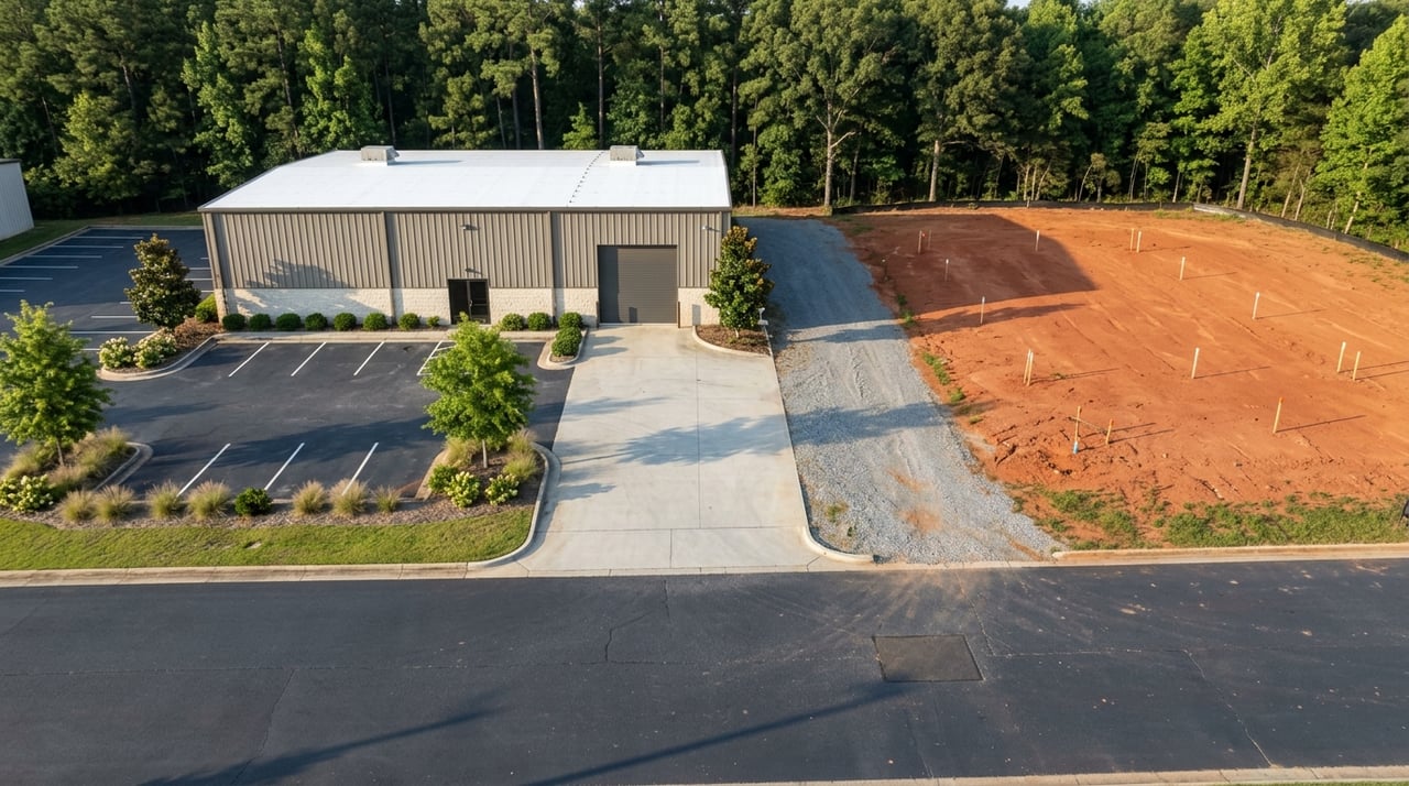
Need more acreage near an interstate exit in Madison? In many cases, acreage is only part of the puzzle. If you are trying to assemble land around Madison’s I-20 interchanges, the real challenge is often frontage, access, buffers, and site layout, not just parcel count. This guide will help you understand how local rules shape assemblage strategy so you can evaluate sites more clearly and avoid costly surprises. Let’s dive in.
Why assemblage matters near I-20
Around Madison, the I-20 corridor is not treated as one uniform stretch of land. City planning materials identify special interchange locations at I-20/US 129-441, I-20/SR 83, and I-20/US 441, and city staff reports show that these interchange areas are evaluated differently from the broader bypass corridor.
That distinction matters because assemblage is usually about creating one workable development site from several smaller parcels. A site may look attractive on a tax map, but once you account for driveway spacing, required buffers, parking, loading, and signage, a small standalone parcel can become much harder to use efficiently.
Madison interchange areas are highly specific
Madison’s long-range planning framework is the Madison Plan 2017-2037, adopted in 2019 to guide growth and land use decisions. Recent city staff reports show support for certain commercial activity near Exits 113 and 114, but they also show that expanding more intensive commercial zoning beyond designated commercial nodes along the bypass may conflict with the Comprehensive Plan.
For you as a buyer, seller, or developer, that means location within the corridor matters as much as size. A parcel near an interchange node may have a very different path than a parcel that sits farther along the bypass.
Interchange parcels are not interchangeable
Two sites with similar acreage can have very different development potential. One may sit in a location where convenience-oriented commercial uses are viewed as compatible, while another may face a tougher review if it falls outside the node pattern recognized by the city.
That is why assemblage strategy should start with the planning map and jurisdictional context, not the asking price. Before you chase more land, you need to know whether the assembled footprint aligns with the city’s future land use direction.
What assemblage is really solving
In this part of Madison, assemblage often solves practical design limits. The zoning ordinance limits curb cuts, requires parking on every developed lot, allows some parking to be combined across separate uses, and allows certain loading areas to be shared by adjacent establishments.
Those rules create a simple reality. A narrow parcel with limited frontage may be much less useful than several parcels assembled into one coordinated site plan. More contiguous control can give you room to place access points, parking fields, loading areas, and internal circulation in a way that actually works.
Frontage can matter as much as acreage
One of the strongest reasons to assemble land near the interstate is frontage. Madison allows a shared pylon sign for retail or service uses in the interstate buffer only when adjoining parcels are subdivided to share the sign location, proper easements are reserved, and each parcel has at least 250 feet of frontage on its street of access.
The ordinance also allows a special interchange sign within 500 feet of the I-20/US 441 or I-20/SR 83 right-of-way intersections. For visible commercial sites, that means assemblage may be driven by frontage and sign coordination just as much as by total land area.
Access rules can make or break a site
Interchange property usually rises or falls on access. Madison’s ordinance limits curb cuts to 30 feet in length, requires curb cuts to be at least 45 feet from other curb cuts and 30 feet from street intersections, and allows one curb cut per 150 feet of frontage up to three per lot.
These numbers matter early. If you are assembling multiple parcels, the goal is not just to gain more dirt. The goal is to create a site with enough frontage and spacing to support a safe, approvable driveway layout.
A larger site still may need restricted access
A 2025 city staff report for 1400 Eatonton Road is a useful local example. Staff found the site consistent with the Interstate Corridor Subarea, but also flagged access safety concerns on US 441 and said the driveway would need to be right-in/right-out only, with a raised island and other physical improvements subject to city and GDOT approval.
That example shows why assemblage alone does not guarantee success. Even after you control enough land, the access design may still limit how the site functions.
Buffers reduce usable land
Another common surprise is how much land can disappear on paper once buffers are applied. Madison requires an interstate buffer along both sides of I-20, except for land within 500 feet of the I-20/US 441 and I-20/SR 83 right-of-way intersections, and that buffer must be at least 100 feet wide with planted or retained dense tree screening.
For you, the practical takeaway is straightforward. A parcel may appear large enough in county records or on a brokerage flyer, but the truly usable development area may be much smaller after buffer, drainage, access, and sign placement needs are accounted for.
Start with net usable area
When evaluating an assemblage, it helps to think in terms of net usable area rather than gross acreage. Gross acreage may get your attention, but net usable area is what supports parking counts, circulation, loading, and building placement.
This is especially important around the interstate corridor, where visibility is strong but physical site constraints can be just as strong. A disciplined early review can save months of time and negotiation.
Jurisdiction comes first
Before you model any site plan, determine whether the parcels are inside the City of Madison or in unincorporated Morgan County. That first step affects which zoning authority, future land use framework, and development review path apply.
Inside the city, property owners may pursue conditional uses, variances, text amendments, or map amendments. Madison also advises applicants to confirm zoning before signing a lease or buying property, and the city notes that if there is a discrepancy, the signed print version of the code controls over online convenience copies.
County-side assemblages need their own review
Outside the city limits, Morgan County is the key local authority. The county handles zoning, future land use patterns, development plan review, flood plain regulations, historic preservation, and occupational tax licensing, and its zoning ordinance includes a range of commercial, mixed-use, industrial, and overlay districts.
That means you should not assume that a corridor strategy on the city side carries over to the county side. County parcels require their own zoning and future land use review, including use of the county’s Public Property Record map.
State access approval is a core issue
For parcels near the interchanges, GDOT access review should be treated as a primary entitlement issue. GDOT states that access management is intended to balance access to development with safe and efficient traffic flow, and its driveway rules require a permit before construction or non-routine maintenance within state highway right-of-way, including development-related work and driveway changes.
In plain terms, if your assemblage depends on a new or modified driveway connection to a state route, that approval needs to be part of your early diligence. It should never be treated as an item to solve at the end.
A practical Madison assemblage checklist
If you are evaluating land around Madison’s I-20 interchanges, this sequence can keep your process focused:
- Confirm jurisdiction by identifying whether each parcel is in the City of Madison or Morgan County.
- Check zoning and future land use before negotiating too far down the path.
- Evaluate frontage and curb cut potential using local spacing and access rules.
- Measure buffer impacts and estimate the real buildable area.
- Test parking and loading layout to see whether shared design options improve feasibility.
- Review signage potential including frontage thresholds, shared sign requirements, and easement needs.
- Treat GDOT approval as essential if the concept involves state-controlled access.
This order reflects how local rules actually affect site viability. It also keeps you focused on the issues that most often separate a promising assemblage from a stalled one.
Why local advisory matters
Assemblage around Madison’s interstate corridor is a strategy problem as much as a land problem. You are not simply buying adjacent parcels. You are trying to create a site that fits the city or county framework, supports safe access, preserves enough usable area, and meets operational needs for visibility, parking, and circulation.
That kind of work benefits from both local market knowledge and disciplined analysis. If you are considering a land assemblage, evaluating frontage strategy, or weighing the best next step for a corridor property, Ashley Goodroe can help you approach the opportunity with clarity.
FAQs
What does land assemblage mean near Madison’s I-20 interchanges?
- It usually means combining multiple contiguous parcels into one more functional site so you can better handle access, frontage, parking, loading, buffers, and signage requirements.
Why is frontage important for Madison interstate commercial land?
- Frontage affects driveway options and can also affect sign opportunities, including shared pylon sign requirements that call for easements and at least 250 feet of frontage on the street of access for each parcel.
Do Madison interstate sites lose land to buffers?
- Yes. Madison requires a 100-foot interstate buffer along both sides of I-20 in many areas, except for land within 500 feet of the I-20/US 441 and I-20/SR 83 right-of-way intersections.
Who reviews zoning for land near Madison, Georgia?
- The answer depends on location. Parcels inside the city are reviewed under City of Madison rules, while parcels outside the city limits are reviewed by Morgan County.
Does GDOT approval matter for Madison interchange development sites?
- Yes. If your project involves work in state highway right-of-way or changes to driveway access on state routes, GDOT permit and access review should be part of your early diligence.
Can a larger assembled site still have access limits in Madison?
- Yes. A larger site may still face driveway restrictions or required design changes if safety and traffic conditions call for them, as shown in the city staff review for 1400 Eatonton Road.